Just back from a road trip to Glacier National Park. It is in Montana and borders Canada for my European readers. The plan was to start the Continental Divide Trail. We didn't put a foot on the ground with a backpack on, but that's another story.
Nowadays we Google our route options, and then use a navigation device in the car to keep us on track. Google said from Oakland, CA, go north through Spokane, WA as fastest choice, a close second was northeast over the Sierras and through Nevada. We were packed and ready to go via Spokane when a last minute check of the weather page showed the jet stream dividing the routes. Oregon Washington was all t-storms and jagged lightning symbols, the Nevada route smiling sun symbols. So, off we go, over the Sierras, through Reno, Nevada, and those little towns from my childhood, Winnemucca, Battle Mountain, Elko, Nevada, and Twin Falls, Pocatello, and Idaho Falls, Idaho.
I say from my childhood, as this was the traditional route we took, from Yellowstone Park, where Dad worked, to California, where all the kin were. The trips I remember were mostly in the 1944-1950 time period, when almost every year we would spend the limited vacation days driving this route, seeing all the relatives in California, and then returning.
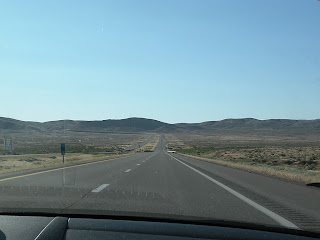
This trip, the Nevada - Idaho section is almost all on Interstate 80, at least two lanes in each direction, flat, and straight as an arrow for 60 to 70 miles at a time. I set the cruise control on the speed limit 75 mph and go that way for hours. During those days of driving from Yellowstone, there was one lane each direction, still straight as an arrow, but undulating, dipping into and climbing out of gentle valleys. There was no white line signalling a safe passing area. The road would look clear of cars for 20 miles, and all of a sudden one would pop up a few hundred yards ahead, hidden in one of the valleys.
This made passing a matter of great concern. There weren't many cars. Those that were there moved along about fifty to fifty five miles per hour. If the car reached 60 mph it began to roar and sound like the engine was getting ready to fly through the hood. Dad was a careful driver, but he liked to go along at about the speed limit (55), so he had a strategy for those slow drivers that would be thwarting his driving rhythm.
You could see them ahead of you, first way down the road, and closer and closer as you overtook them. The important thing was to minimize your time in the lane with oncoming traffic. So, Dad would make his move. About a half mile before the offending car, Dad would stomp on the gas. Nothing happened instantly, but we would be gaining speed. At the same time, Dad would be watching down the road, trying to guess where the next long stretch with no dips would be. He would time it so he would hit the start of that long stretch at the same time as he came up to that slow moving car, whip to the left into the oncoming traffic lane, pass the car going about 30 mph faster than it was, and whip back into the safe lane, decelerating to a normal speed. We kids thought it was great fun. Mom must have had total trust in Dad because she took it in stride, but looking back, I suspect that it must have aged her a little.
When we returned from this recent Glacier trip, we took the Washington Oregon route, much of which is on US 97, a one lane each direction highway not a whole lot different than those of Nevada in the 40s. I thought about Dad's technique few times, but the newer cars have a little more get up and go, so I was content to wait for a very safe opportunity or a passing lane. Of course, I'm about thirty years older than Dad was during his passing days, so there might have been a testosterone basis.
One last variant of Dad's method was what he used in Sequoia National Park, and taught to me. There was a sixteen mile extremely curvy road from where we lived at 3000 feet elevation, up to the primary park area at 7000 feet. This road was a continuous series of S curves, limiting you to about 15 mph on outside curves, and 20 on inside curves. Each outside curve was totally blind, but you could see a long ways up the road. Once you have memorized the road, you can tell from looking up the road whether there is a car coming or not. So, if a car was not coming, Dad would just pass the car ahead of him on an inside curve, terrifying the other driver, who thought a car might appear at any second. I learned to drive on this road, and soon used the same technique. Never have had a road since where such a move would be appropriate.


This is a great story about your father and the way one drove in those days. Thank you :-)
ReplyDeleteLove those road trips! I can feel the wind through the side windows and the whoosh of passing cars. For us Westerners, there's nothing like it. Keep up the splendid pieces on your trails and travels.
ReplyDelete