Posts

Showing posts from February, 2010

Kindle Once Again - this time for Walk, Hike, Saunter

Image
 Last time I did this was Dec 2017. At the moment, memory of how to do it is pretty foggy, but luckily I have my earlier blog posts on this to refresh my memory so printing them out to review. (look for Kindle label in this blog to find).  This book is a little easier than the others - text and inline photos, a table of contents, but no index. Susan has promised it will be out in two and a half weeks, so will try to do that. My immediate issue is that I remember that I have to make some changes to the Indesign file before putting out the epub file that I will update for Kindle, but don't remember quite what they were. Pausing to read my prior posts, and to review Kindle code for Healing Miles . From my 2012 notes I saw that to get reliable chapter breaks, each chapter had to be a separate xhtml file. The default of Indesign is to put out one big xhtml file, but it will break on a style, so I need to be sure the current Indesign document (for Walk, Hike, Saunter ) has an appro...
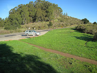
Bay Area Ridge Trail south from Chabot to Cull Canyon and loop return

Image
Warning - local interest only. If you are one of my out of the area readers then this is definitely more than you want to know. On the other hand, if you are going to walk this route, better read it. Synopsis: You really need to carry a map on this trip, and review it before the walk. When you get to the bench with no back, less than a mile down the trail, take the small dirt track going down to the east, marked only by a No Bikes sign. A photo of the bench is a little farther down. The full story: Starting from a small day use lot just past the Chabot Rifle Range, my destination was Cull Canyon park. It was intended to be a down and back, but inadvertently turned into a loop. It's best to take a good look at a map before starting, or even better, bring it along. I didn't do either. I knew where the end point was, and the start point, and my sense of direction is good, so I just took off, assuming that I could find my way with the trail markers. I did have the gps, but th...