Posts

Showing posts from 2010

Kindle Once Again - this time for Walk, Hike, Saunter

Image
 Last time I did this was Dec 2017. At the moment, memory of how to do it is pretty foggy, but luckily I have my earlier blog posts on this to refresh my memory so printing them out to review. (look for Kindle label in this blog to find).  This book is a little easier than the others - text and inline photos, a table of contents, but no index. Susan has promised it will be out in two and a half weeks, so will try to do that. My immediate issue is that I remember that I have to make some changes to the Indesign file before putting out the epub file that I will update for Kindle, but don't remember quite what they were. Pausing to read my prior posts, and to review Kindle code for Healing Miles . From my 2012 notes I saw that to get reliable chapter breaks, each chapter had to be a separate xhtml file. The default of Indesign is to put out one big xhtml file, but it will break on a style, so I need to be sure the current Indesign document (for Walk, Hike, Saunter ) has an appro...

A wet morning at Blade Creek

Image
A bearing of about 99 degrees from Oakland, and a distance on that southeast path for 207 kilometers, puts you in the foothills of the Sierras, at a spot that we have visited biannually for at least twenty years now. Once in late fall to plant daffodil bulbs, and once in the spring to view the results. This property is much loved and little tended. Trees fall, creatures make little paths, seasonally, creeks flow, seasonally tarantulas roam and lizards scurry. Our friends, who own it, use it as a retreat, for years using a trailer that came with the property. They finally succumbed to the lure of running water and a flush toilet and have a more permanent structure. Last weekend was the planting weekend -  a wet one. I took an early morning walk - quite beautiful, once I adjusted to wet feet and a water table at a depth of about one inch. These are some shots from that stroll.

Yosemite - a sinful fall escape

Image
I have a vast appetite for avoiding doing the things at the top of my list, so when Susan got lodging discount tickets for joining Yosemite Association, and suggested a mid week weekend getaway, I was ready. My brain was Kindled out from digging into details about converting a book to Kindle. Off we went in the Subaru, expecting that we might need four wheel drive, based on snow forecasts. About 50 miles out, I realize I've left the chains at home, so we opted for the longer and lower route up through Mariposa rather than up and over the mountains via Crane Flat and down to Yosemite valley. For our last pct trip, we had invested in an Ipod Touch, so we would have some means of internet access at our resupply points. It worked well for that purpose, but I hadn't used it for much else, other than my calendar. I had loaded all our music cds down to it, but did nothing with them. A few weeks ago, I got this car charger for the ipod that also had a little fm transmitter, that wo...

A Few Fall scenes at Coyote Hills Regional Park

Image
One dark day near Halloween, we took our grandson south, hoping for better weather. We are surrounded by regional parks, most with hiking trails, but some with historic value. Our destination was Ardenwood, a working farm from 100 years ago, now farmed by the park district. Blacksmiths, horses, cows, corn, pigs and pumpkins all are kid worthy attractions. Since Halloween was upon us, we expected some special events. Alas, the budget cuts have struck, so no special activities. The blacksmith was there, pounding away, but he didn't even have his forge going. So, after surveying the farm animals, and getting hot dogs at the little cafe, we huddled under the cafe porch roof, keeping out of the rain. What now? Well, Coyote Hills was just west of us and it had a boardwalk out into the freshwater marsh. Maybe we could surprise some ducks. Good choice. The rain stopped, and we strolled along the boardwalk, taking in the fall scene. Finally wrapped up the day by going out to the fishing ...

Converting our books to Kindle - work in progress

Image
This is an as it happens log of my efforts to convert our print book We're in the Mountains, Not Over the Hill  to Kindle. In the process I hope to clarify my own thinking about how to do this. The book has about 20 b&w photos and a lot of carefully crafted layout. Several fonts, use of bold, italics, multiple paragraph formats, all to make the book look well done to the reader. The intent is to have the layout help communicate the book's message. Our print version was created with Pagemaker and resulted in a pdf file which was sent to the printer. The book sized Kindles require an Amazon proprietary format which is a subset of html. You can give Amazon a Word, PDF or HTML file, and they will automatically convert it to their format (free). You have the most control over the resulting appearance if you give them html, the least control if you give them a pdf. There are Kindle readers on all sorts of devices: IPhones, IPads, etc. Kindle is b&w and only a couple...

Trail of 4 Cities Meander

Image
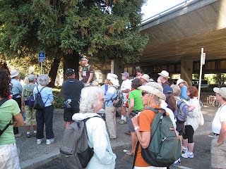
Who knew. I took part in an urban hiking event Sunday, little knowing that I was participating in a pedestrian critical mass. For those of you in my extended audience, Critical Mass is an anarchist sort of bicycle gathering monthly in San Francisco. Through sheer volume, they take over streets, roll through stop signs and red lights, causing consternation and curses in the unaware motoring public. I live in a belt of cities along the east shore of San Francisco Bay. I'm in Oakland, the one of which Gertrude Stein said "there is no there, there". A gross slander, by the way. To the north is Berkeley of international fame, University of California, student dissent, etc. and my alma mater. North of that is a little wedge called Albany, which  we will forever after ignore in this post, then an upscale community - Kensington. We got married in the First Unitarian Church of Kensington, only for some reason, they call it the First Unitarian Church of Berkeley. And, Finally, E...

Couple or partner hiking safety issues

Image
There is one serious hiking issue that is unique to two people hiking together. This is the accidental passing. You think the other person is ahead when he/she is really behind. Your attempts to catch up only worsen the problem. I have seen this happen once to another couple in Europe, and on the isolated environs of the PCT it is much more serious. We are serious about safety and attempt to be prepared for any weather that might come up. However, our gear is split. The two of us together have everything we need,  but neither carries enough to get through a night on their own without problems. About all we each have is a space blanket and a sleeping bag. Consequently, we are quite careful not to get accidentally separated. If the person ahead is out of sight of the other, and has to go off the trail, they either leave their poles or their backpack on the trail, so they can't be accidentally passed. Believe me, in my hiking head-down mode, I can miss something two feet off the t...

Feeling a lot of empathy for those PCTers in Washington right now

Image
The Dinsmores, and the pct-l forum report lots of rain. Fortunately the resupply points are five to seven days apart for strong hikers, so if everything is wet by the fifth day, just a day or two more till you reach civilization. I've already sent off my Stephenson's Warmlite to get endliners, which will reduce condensation in the front and back of the tent, should we ever be so foolish as to ever attempt such a trip again. I'm still investigating how to cook in the tent - seems risky at best. Even if we don't burn our shelter down, how much oxygen do two people need in a Warmlite, and how much is used up if you take 7 minutes to boil a liter of water in the tent? Maybe I should get one of those carbon monoxide warning devices, put it in the tent while we boil a pot of water.

Completed Pacific Crest Trail, Sept 7, 11:10 am

Image
A long time coming, but we finally reached the monument marking the Canada-US border. Our first segment of the trail was in 1989, but we have done the majority of it since 2004, in a couple of 200 to 300 mile trips each year. This year we decided we didn't know how long we could keep doing this, so did the last 470 miles in one 5 1/2 week trip. It's way too much stuff to put in a single blog post, so I'll just post from time to time on whatever comes to mind about the trip. One is that Washington weather is different, particularly northern Washington. If I lived up there I would have to rethink my gear for wet conditions. We had rain and snow, which we've experienced before, but never with days on end with no sun or wind to dry things out. Our waterproof socks made things comfortable as long as we could start the day with dry liners, but by the end of five days, all socks were wet, tent was wet, fleece was a little damp, down bag a little damp and we were a little we...